Click here to subscribe today or Login.
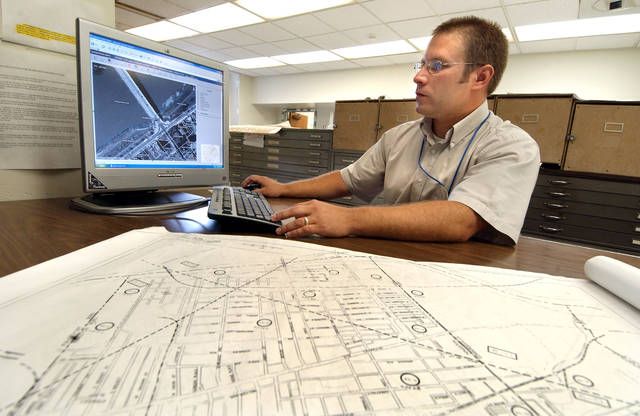
A manager who shepherded Luzerne County government’s switch from paper maps to a digital system a decade ago is departing for a job in the private sector.
David Skoronski, the county’s GIS (Geographic Information Systems) director since April 2006, said he will wrap up his county employment Sept. 8.
Skoronski received $59,914, and the position has been advertised at a salary of $55,000 to $59,000.
His replacement will oversee all county computerized mapping programs, the department and a staff of five. Applicants must have a bachelor’s degree in computer science, computer information systems or a related field with an emphasis in GIS techniques.
At least seven years of GIS project management experience and familiarity with a range of software programs also is required. Sept. 12 is the application deadline, according to the posting on the career opportunities page at www.luzernecounty.org.
Prior county commissioners originally bought the GIS program for approximately $1 million to help with the countywide reassessment that took effect in 2009, but they asked Skoronski to add data for other departments because the system had so much useful potential.
Among the offices that use the program in addition to the assessor’s office, according to Skoronski: planning/zoning, 911, voter services, emergency management, the sheriff’s department, and road and bridge.
The system shows boundary lines and tax/ownership information for more than 165,000 parcels in the county, Skoronski said.
Setting up the program was a challenge because thousands of boundary lines hadn’t been properly pinpointed on the county’s 1,400 paper maps, requiring additional research of deeds and survey books, some on crumbling records dating to the mid-1800s.
The printed versions had to be scanned, “stitched together” and resized for consistency to create the countywide digital map, he said.
Accurate property boundary lines were crucial because they are the foundation for “layers” of data loaded into the system. Building footprints continue to become more precise due to periodic aerial photography.
The digital system also aids economic development because it quickly generates records for developers and parties involved in buying and selling property, officials have said.
Humble and content to remain behind the scene, Skoronski downplayed his importance.
“It always was a team effort,” said the Fairmount Township resident.
Much of his focus lately has been on the creation of an online mapping portal that will allow the public free access to the system’s basic property information.
The digital map will never be finished because parcels in the 900-square-mile county are constantly changing hands, consolidating and subdividing, Skoronski said.
“It’s a moving target. It’s dynamic,” he explained.
Skoronski said he viewed his county employment as an opportunity to maximize a publicly funded asset.
“I’m a taxpayer. I want fiscal responsibility,” he said.


